Wednesday, June 23, 2021

Day 22 - Coeur D’Alene ID

Miles today: 343
Miles total: 7584

Headed out of Seattle east on US-2 ... overcast and low 60s ... up through Steven’s Pass, then followed the whitewater of the Wenatchee River for a bit.


Stopped at the nice little faux Bavarian village of Leavenworth.


Shortly after that, between Orondo and Waterville, the mountains abruptly end and the geography turns into the dry plains of eastern Washington. Temps are now around 90.


Which then leads to coulees (trenches) formed at the end of the last ice age.


Took a slight detour north to see the Grand Coulee Dam on the Columbia River.  A contemporary of the Hoover Dam, it’s almost 4 times as massive and produces over three times as much power (6800 MW). It’s the largest hydroelectric producer in the US. 


Tuesday, June 22, 2021

Day 21 - Seattle WA

Miles today: 286
Miles total: 7241

Somewhat boring ride up I-5 to Seattle.  Stopped in Olympia to see the state capitol.


Interestingly the governor’s mansion is literally right next to the capitol.  Can’t really see the house through the foliage though.


Sunset over Lake Washington, with Mt Ranier in the background.


Monday, June 21, 2021

Day 20 - Salem OR

Miles today: 337
Miles total: 6955


Though Salem is not far from Eugene, the plan was to ride due west to the coast to Florence, take US101 up the coast to Canon Beach, then loop back down to Salem via McMinnville.  The coastal part was a bust. The entire shoreline was so fogged in you could barely see the ocean. And only a small fraction of 101 actually runs along the water; the inland parts, while free of fog, were nothing special ... looked a lot like riding US64 in NC to me.  The only photos worth taking were of the some of the nice 1930s era bridges.


Went through Tillamook, passed the massive Tillamook Creamery, and stopped to take a photo of the huge WWII blimp hangar — currently the largest clear span wooden structure in the world.


Stopped at the Evergreen Aviation Museum in McMinnville to see the Hughes Hercules (aka Spruce Goose).  No good way to really photograph the whole thing and get the right perspective. 


I spoke with one of the volunteers there for a bit and he told me that the big box to the right the stairway leading to the cockpit was a gigantic HEPA filter for the germaphobe Hughes. The whole cockpit was fed filtered air, and Hughes himself had his own dedicated hose (black hose drooping from the ceiling):


9-ply laminated birch fuselage skin ... and none of it has delaminated in 70 years.


From McMinnville to Salem I rode through part of the Willamette Valley, passing a number of.vineyards.  Whereas Napa seems to be dominated by big dollar estate wineries, the Willamette appears to have a lot of blue collar wineries run by farmers. And the rest of it is weeds and scrub. Not the most picturesque place. 

I will say that the Oregon State Capitol, from the outside anyway (didn’t go inside), is a terrific Art Deco structure.  I’d rank it #2 — behind Lincoln NE.


Sunday, June 20, 2021

Day 19 - Eugene OR

Miles today: 436
Miles total: 6618


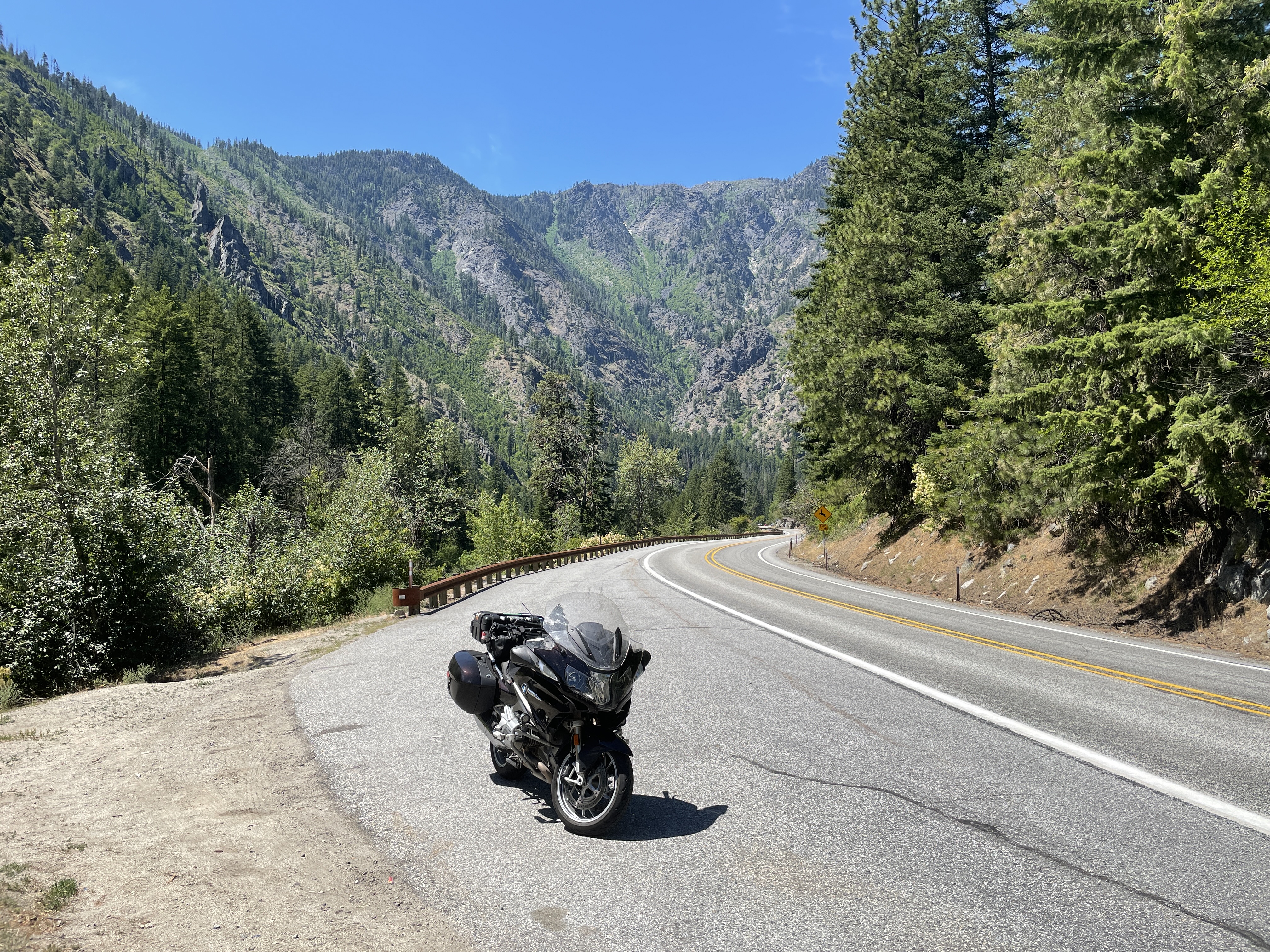
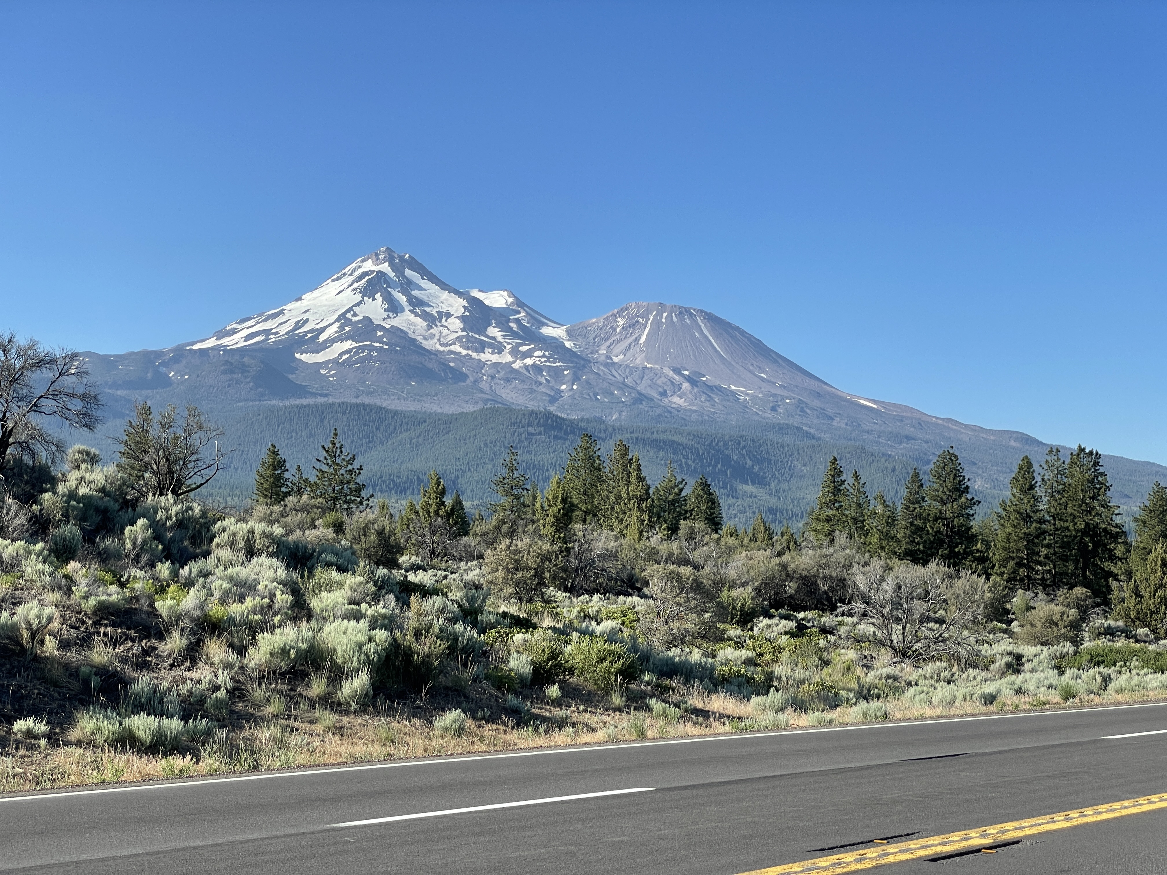
Left the Green Gables Motel at 6:15 ... 51 degrees, nice.  Took CA-89 to Mount Shasta, briefly up I-5, then exit at Weed to US97.  Superb roads.  Mt Shasta is the dominant geographic feature for about 45 minutes. You first see it directly in front of you as you crest a hill on 89, but there are lots of trees limiting photo ops. Best clear views for me were from 97.


Stopped in Klamath Falls for breakfast and continued up US97 to OR-62, passing Klamath Lake on the way to Crater Lake National Park south entrance.  Enter the park at an elevation of about 4200 feet and climb over the rim at about 7200 feet.  Seeing Crater Lake for the first time is a bit like seeing the Grand Canyon ... you’ve seen pictures of it, you know what it looks like, but as soon as you come down the rim get the first view it just smacks you in the face.


I went around the west rim, stopped at the obligatory overlooks, headed out the north entrance to OR-138 and up US97 some more (all part of the Volcanic Legacy Scenic Byway) to Bend.

At Bend I had to stop and visit the last Blockbuster on the planet.


I went inside but most of the good merch was picked through; not much left but 3XL shirts.  Enjoyed watching a stream of people pull into the lot, jump out, and have their picture taken in front of the sign.

From Bend I went through Sisters, then left at the lava field to get on OR-126 which eventually follows the McKenzie River to Eugene.  Generally great riding all day except for smoky haze limiting visibility on the way to Bend, and temps near 100 for the last 50 miles to Eugene.

Eugene is where “Animal House” was filmed so I took a walking tour of the U of O campus to see the highlights.  Here’s the building used as a stand-in for “Emily Dickinson College” in the movie


Admin building and Dean Wormer’s office


Omega house and Pi Pi Pi sorority (Delta House, which was between them, was torn down in the 80s).


Saturday, June 19, 2021

Day 18 - Burney CA

Miles today: 325
Miles total: 6182

Since Redding was forecast to be 111F today I left Calistoga at 6:15am to beat as much of the heat as I could.  Headed south to St Helena, then took a series of back roads east to Lake Berryessa.  


Shortly thereafter I encountered a major problem in my route: 20 miles of the absolutely worst paved “road” I’ve ever been on - in any vehicle. Problem was I was already too deep into the route to go around it.  Crawling along at 20-25mph set me back 30 minutes. Here’s a shot of one of the better sections of pavement:


The only other vehicle I saw on that road was a Jeep Wrangler with big off-road tires, also plodding along at about 20-25.

At Colusa I followed the Sacramento River north to Codora, then east to Oroville.  I wanted to see the dam that had that spectacular spillway failure a few years ago.  Tallest dam in the US (770 feet). Unbelievably huge. 


It’s obviously been repaired but it also looks like they rebuilt the whole face of the dam around the spillways. Compare it to the photos on Wikipedia right after the failure.

From there I headed to Chico and then up to Lassen Volcanic National Park.  It’s the southernmost end of the Cascade volcano range, and Lassen Peak is the tallest plug dome volcano in the world.  


The highway that loops through the park is a great drive, not insanely crowded like the Going-To-The-Sun road.  And at elevations from 5500 to 8500 feet the temperatures were only in the 80s. 


I only had to endure temps in the 90s and 100s for about and hour and a half all day. 

Friday, June 18, 2021

Day 17 - Calistoga CA

Miles today: 323
Miles total: 5857

Left Cayucos at 6:40am ... 59F and foggy. Not much visibility for the first hour.  At San Simeon I had hoped to at least drive up to Hearst Castle but the road is closed, and with the fog you can’t see anything from the PCH. Instead I spent some time at the elephant seal viewing area, which was probably a better way to spend the time anyway. 


One the fog lifted the ride on the PCH was pretty spectacular. No traffic to speak of for the first 100 miles. 


Stopped for food in Big Sur, successfully refueled, and continued up the PCH.

The famous Bixby Bridge near Big Sur (1932):


Some spots of traffic through Monterey and downtown Santa Cruz. Then things came to a grinding halt halfway between Santa Cruz and Half Moon Bay because of repaying work. Stuck for 30:minutes. Of course things got really slow through the San Francisco peninsula, and just to take a picture of the bridge cost another 30 minutes because of parking closures. 


At least there’s no toll northbound. 

Still a lot of slow traffic on CA-1 north of the bridge. The road has plenty of turnouts for slow traffic but only about 1/2 of the cars I came up on got the hint and actually used them.  


At Point Reyes I headed east on the back roads and, in the interest of time, grudgingly picked up 101 at Petaluma. Within minutes of turning east the temperature shot up from the upper 60s to upper 90s. The Napa Valley was around 100 today.  Tomorrow looks it will be just as crappy. 


Thursday, June 17, 2021

Day 16 - Cayucos CA

Miles today: 189
Miles total: 5534

Got up at 3:30am Eastern to catch a 4am Uber to CLT for a 6am flight.  2 hour layover at DFW; flight to Fresno was delayed 1/2 hour to fix a broken seatbelt. Arrived in Fresno around 11am Pacific time.  Proceeded to take the shortest Uber ride I have ever taken because I was too hot and tired to walk from the terminal to the storage unit (just under 1 mile, approximately a 3 minute ride). The driver was strangely cheery and chatted me up for those 3 minutes though. 


Got the bike out of storage, reconnected the battery, repacked a few things, changed into riding gear, and signed out of the unit.  Just after I left Airport Mini-Storage I stopped to fill up but, because California gas stations have vapor return nozzles, I once again proceeded to spray myself with gas while trying to fiddle with the return hose so the pump would work.  So far I’m only about 50/50 filling the bike in California without making a mess.

Headed south from Fresno on a really uninteresting, flat, straight road, CA-41. And it was ridiculously  hot. For two hours it ranged between 105F and 108F.  At least at Shandon CA-41 suddenly became a really nice road with no traffic, lots of sweepers and small hills, good visibility in the corners, and excellent pavement. But it was still really hot. 

Just past Atascadero I could feel the temperature start to drop, and it steadily dropped about a degree every 30 seconds for the next 20 minutes. When I reached Morrow Bay on the Pacific it was 67F. 


From there I headed up the Pacific Coast Highway for only about 6 miles to Cayucos, a little beach resort town.